Categories
Shopping cart (0 items € 0)
Advanced search

Middle East & Islamic World / Arabian Peninsula & Gulf States

Ephemera, including Arab constitutional documents and an introduction to the history of Arab medicine

[ARABIA - EPHEMERA]. [A collection of ephemera regarding the Arab states].
New York & London, The Arab Information Center, 1951-1962 8vo. Comprising:
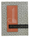
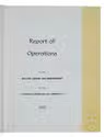
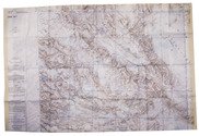
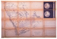
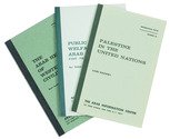
(1) EL-KHATIB, M. Fatallah (foreword). Basic Documents of the Arab Unifications. New York, Arab Information Center, June 1958.
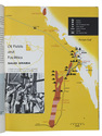
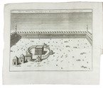
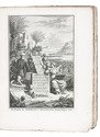
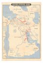
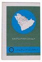
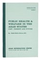
(2) OMRAN, Abdel-Rahim. Public Health & Welfare in the Arab States: Past, Present and Future. New York, Arab Information Center, November 1959. The booklet opens with a history of the Arab contributions to medicine followed by modern statistics.
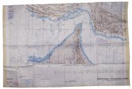
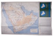
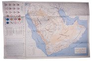
(3) WRIGHT, Esmond. The Arab World. Current Affairs no. 125. London, Bureau of Current Affairs, 3 February 1951.
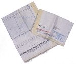
(4) [MENU]. P&O menu. On board the S.S. Arcadia, Sunday 25 March 1962.
2 booklets, a magazine and a menu, all in original publishers wrappers. 43; 32; 19, [1]; [4?] pp. Full description
€ 1,800
Order Inquire Terms of sale

Abundantly illustrated performance report of ARAMCO in 1955

ARABIAN AMERICAN OIL COMPANY. 1955 Report of operations to the Saudi Arab government.
[Dhahran], Saudi Arabia, Arabian American Oil Company, 1956. 28 x 21.5 cm. With a portfolio of photographs, 8 pages in the middle of the work, with captions in both English and Arabic. Thoroughly and colourfully decorated with photographs, maps and other decorations in the text. The 56 pages of text appear twice in the present work as published, once in English on the left side of the portfolio and once in Arabic on the right side of the portfolio. Original publisher's decorated wrappers, with the title in English on the front wrapper and the title in Arabic on the back wrapper. VIII, 48, [8 - portfolio of photographs], 48, [8] pp. Full description
€ 750
Order Inquire Terms of sale

USAF pilot's map of the Arabian Gulf

[MAP - ARABIAN GULF]. Aeronautical chart and information center. Persian Gulf | ONC-H-6/7. Operational navigation chart.
St Louis, Aeronautical chart and information center, United States Air Force, 1969. Two copies of two folding maps colour printed on both sides of a sheet of silk (103 x 78.5 cm) on a scale of ca. 1:1,000,000. The two maps (ONC-H-6 & ONC-H-7) show one continuous area. Full description
€ 2,800
Order Inquire Terms of sale

The life of Muhammad and a history of Arabia under the first four Caliphs

[ARABIAN HISTORY]. Hedendaagsche historie; of het vervolg van de algemeene historie; ... Behelzende het leeven van Mohammed; en het begin van de historie der Arabieren, onder de drie eerste Khalifs ...
Utrecht, Hermanus Besseling (vols. 1-2), Leiden, Amsterdam, P. van der Eyk, G. de Groot and son, K. van Tongerloo and P. Schouten (vol. 3), 1760-1764. 6 parts in 3 volumes. 4to. With 3 engraved frontispieces, engraved coat of arms and 6 folding plates. Contemporary boards covered with sprinkled paper. Full description
€ 5,000
Order Inquire Terms of sale

Abu Dhabi's Oil industry: the Israeli perspective

[MAP - ARABIAN PENINSULA OIL RESOURCES]. Neft ba-mizrah ha-tikhon. Zikaynot, shadot, tzinorot, batei zikuk. [= Oil in the Middle East. Concessions, oilfields, pipelines, refineries].
Tel Aviv, Israel Defence Forces, General Staff, [1957]. 56 x 82.5 cm. Chromolithographic map of the Arabian Peninsula, from Turkey in the north to the Indian Ocean in the south, and covering Saudi Arabia, Egypt, Israel, Palestine, Jordan, Syria, Lebanon, Iraq, Iran, Kuwait, Bahrain, Qatar, United Arab Emirates, Oman, North and South Yemen. Scale 1:5,000,000. Scale and key in Hebrew inset to top-right, inset explanatory panels in Hebrew and English, compass rose in Saudi Arabia. Folded. Full description
€ 7,500
Order Inquire Terms of sale

Large folding road map of Saudi Arabia

[ARAMCO]. Saudi Arabian road map.
Dammam, Al-Mutawa press company, 1973. Large folding map (60 × 90.5 cm), printed in light orange with darker purple, depicting the Kingdom of Saudi Arabia and its main roads. With on the right the title in both Arabic and English and a table with the distances from one city to another. Full description
€ 1,800
Order Inquire Terms of sale

Surviving traffic in Saudi Arabia, a large folding map

ARAMCO. Saudi Arabian road map.
Dammam, printed by the Al-Mutawa Press for the Arabian American Oil Company, 1973. Large folding map (60 x 90.5 cm), printed in colour, depicting the Kingdom of Saudi Arabia and its main roads. With on the right the title in both Arabic and English and a table with the distances from one city to another. Printed on two sides, one side with the map in English and the other in Arabic. Full description
€ 1,800
Order Inquire Terms of sale

Surviving traffic in Saudi Arabia, a large folding map

ARAMCO. Saudi Arabian road map.
Dammam, printed by the Al-Mutawa Press for the Arabian American Oil Company, 1975. Large folding map (60 x 90.5 cm), printed in colour, depicting the Kingdom of Saudi Arabia and its main roads. With on the right the title in both Arabic and English and a table with the distances from one city to another. Printed on two sides, one side with the map in English and the other in Arabic. Full description
€ 1,500
Order Inquire Terms of sale
211 books found / Show all
Recently viewed