MAASKAMP, Evert.
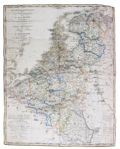
Geschiedkundige kaart der Nederlanden. | Carte historique des Pays-Bas.
Amsterdam, Evert Maaskamp, 1830. Map (plate size 48 x 38 cm) engraved by "Giersbergen et fils", printed on silk and hand-coloured in outline, with the title at upper left, a dedication at lower left, and a key and scale (ca. 1:1,000,000) at lower right.
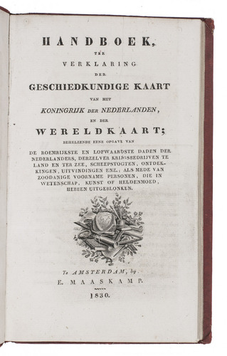
With: (2) MAASKAMP, Evert. Handboek, ter verklaring der geschiedkundige kaart van het Koningrijk der Nederlanden, en der wereldkaart; behelzende eene opgave van de roemrijkste en lofwaardste daden der Nederlanders, derzelver krijgsbedrijven te land en ter zee, scheepstochten, ontdekkingen, uitvindingen enz.; als mede van zoodanige voorname personen, die in wetenschap, kunst of heldenmoed, hebben uitgeblonken.
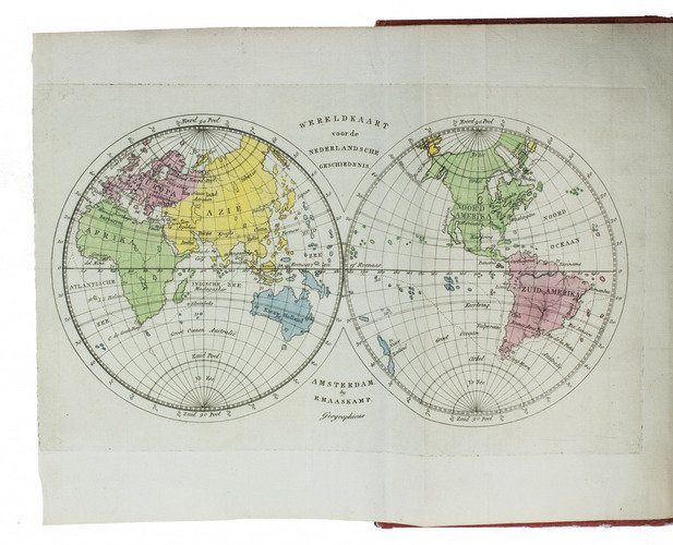
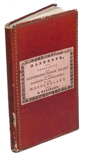
Amsterdam, Evert Maaskamp, 1830. 8vo. With a folding engraved map of the world, with the continents hand-coloured. Contemporary red boards, boards gold-tooled along the extremities. VIII, 8, 1-38, 37-77, [1 blank], [1], [1 blank].
€ 1,500
Ad 1: Rare historical map of the Low Countries (Belgium, Luxemburg and the Netherlands), hand-coloured in outline, and published by the Amsterdam book and print seller Evert Maaskamp (1769-1834). The map shows various battles at sea and on land, illustrated with tiny ships or tents and accompanied by the date of the event; residencies of important rulers, places where peace treaties were signed, etc. The map was sold on paper and on silk, the additional manual, Handboek ter verklaring der geschiedkundige kaart ... was available separately.
Ad 2: Rare first edition of a work on the history of the Netherlands, listing numerous important historical, mostly military, events up to 1830, also published by Maaskamp in addition to the Geschiedkundige kaart. The book opens with an engraved world map, with each continent hand-coloured in a different colour. It first lists all the major events takings place in or near the Netherlands, followed by a list of Dutch activities overseas. Starting with the settlement of various peoples in different parts of the Netherlands in the centuries before the common era, it goes on to describe the conquests by Julius Caesar, later Roman battles, Norman invasions, the power shifts of various royal houses, large medieval battles, etc. Arriving in the 16th and 17th century, it mentions the major events of the 80 Years' War, but also the escape of Hugo de Groot and the visit of Czar Peter the Great to Zaandam, followed by battles against the French and the English and the events during the rule of Napoleon Bonaparte. The other list mentions (Dutch) crusades and pilgrimages, battles at sea, voyages to Nova Zembla, the East and West Indies and Australia, focusing on the Dutch in Indonesia and Brazil.
Ad 1: Creased and with a few tiny holes, otherwise in good condition. Ad 2: Text leaves in very good condition. Binding slightly worn along the extremities, minor damage along the hinges. L. Brink, Nederlandse geschiedkundige schoolwandkaarten (2014), p. 21; Koeman, Gesch. kart. der Nederlanden, p. 253 (citing Mees); ad 2: NCC (5 copies).
Related Subjects: