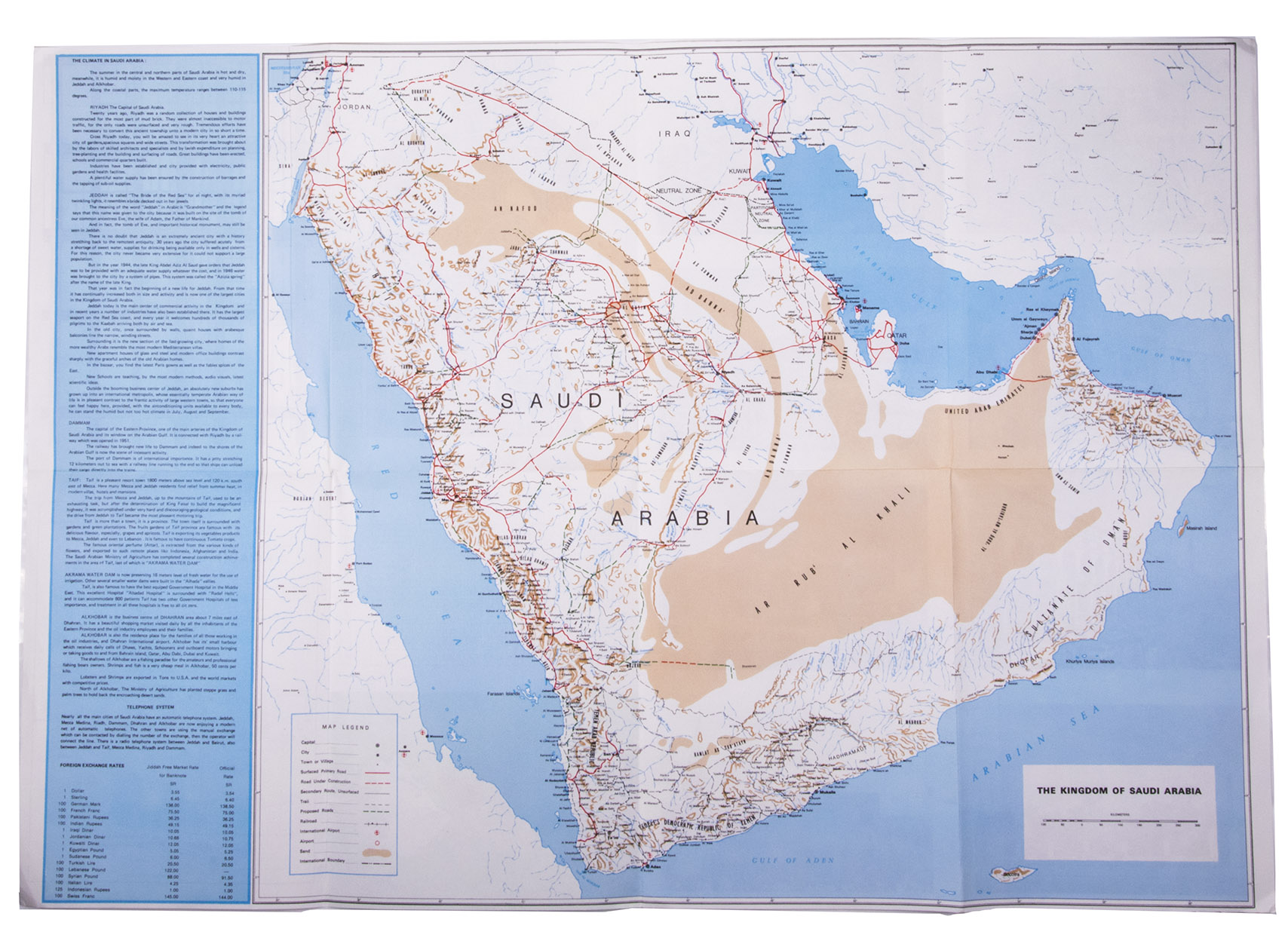
[SAUDI ARABIA – MAP].
Road map of Saudi Arabia: accurate and most up to date road map.
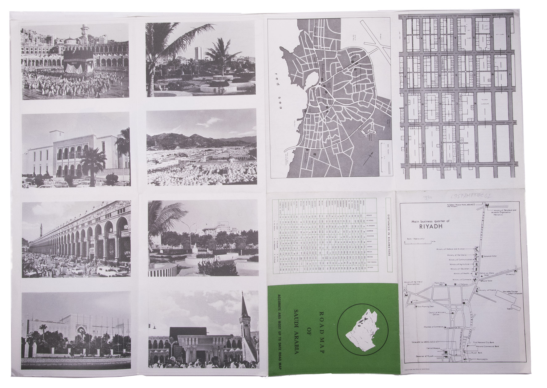
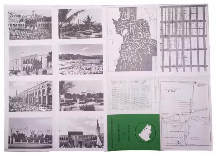
Karachi, Pakistan, printed at Golden block works, [1970s]. Colour-printed folding map (48 x 69.5 cm) of the Arabian peninsula (scale: ca. 1:5,000,000), with on the back a city map of Jeddah, a plan of the main business quarter of Riyadh, a city plan of Dammam(?), a distance table and 8 photographic city views.
€ 1,750
Folding map of the main roads of Saudi Arabia, but depicting the whole Arabian peninsula and including the Sultanate of Oman, meaning the present state must have been published in or after 1970. On the left of the map text giving information on the climate, Riyadh, Jeddah, Damman, Taif, the Akrama water dam, Alkhobar, the telephone system and the exchange rates. The reverse side of the map includes plans of Jeddah, Riyadh, Dammam and 8 photographic city views.
In very good condition.
Related Subjects: