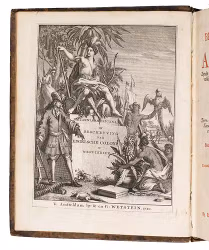
[OLDMIXON, John].
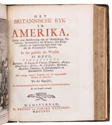
Het Britannische Ryk in Amerika, Zynde eene Beschryving van de Ontdekking, Bevolking, Inwoonders, het Klimaat, den Koop-handel, en tegenwoordigen Staat van alle de Britannische Coloniën, In dat gedeelte der Wereldt... Uit het Engelsch, Als mede een omstandig Berecht aangaande Koffy en Koffy-plantery, Uit het Fransch vertaald.
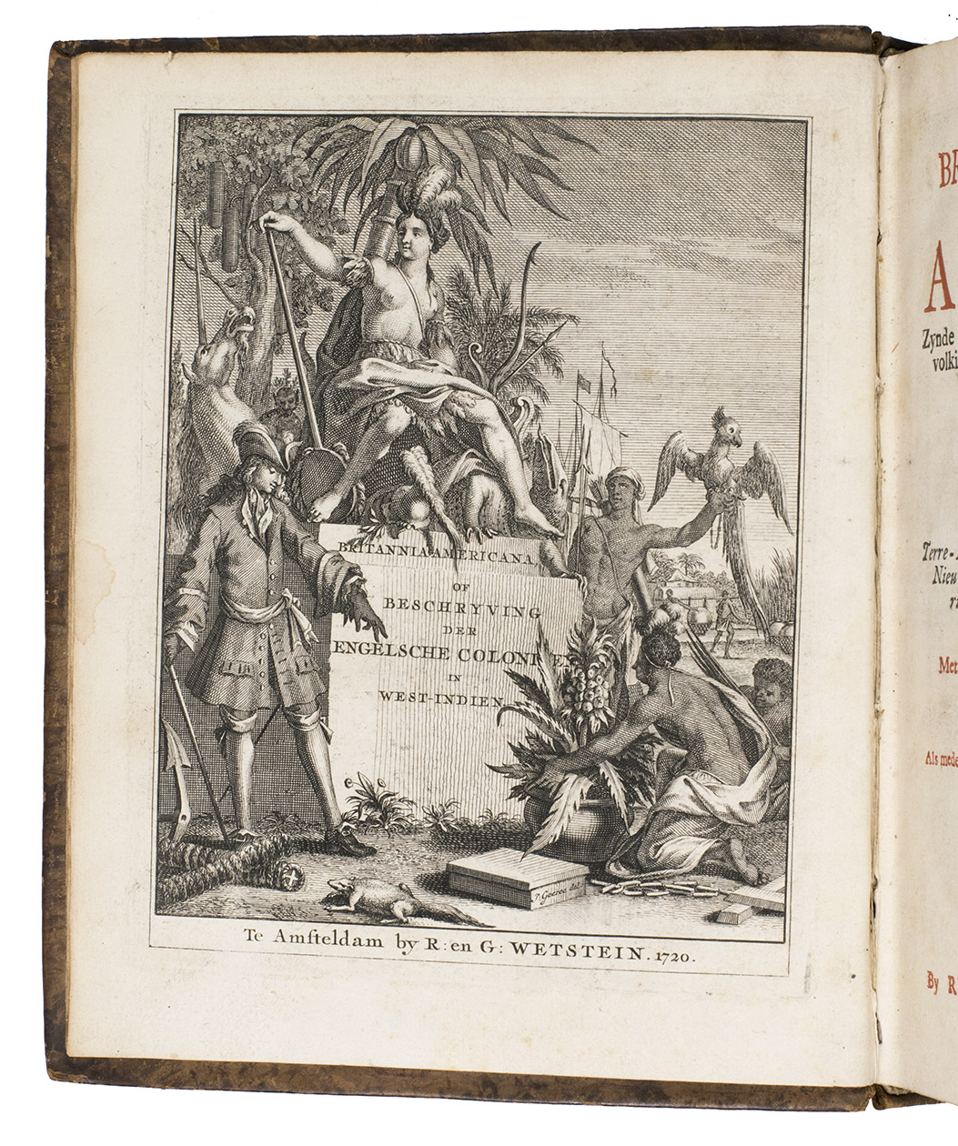
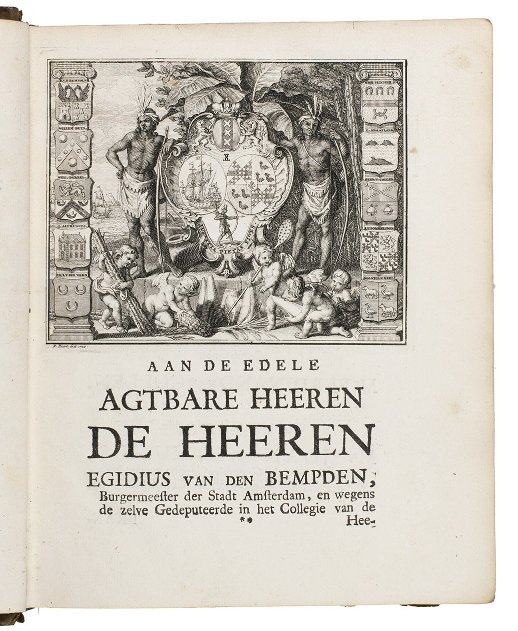
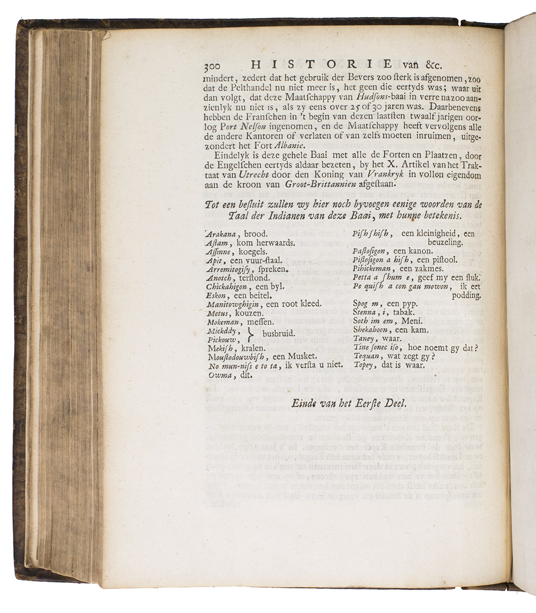
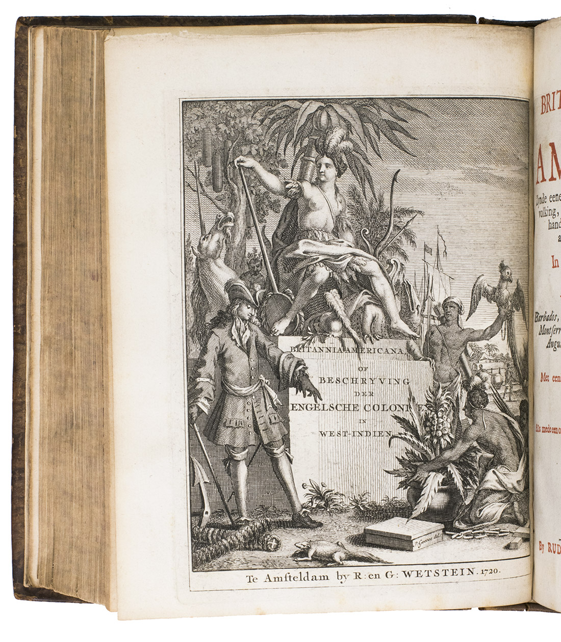
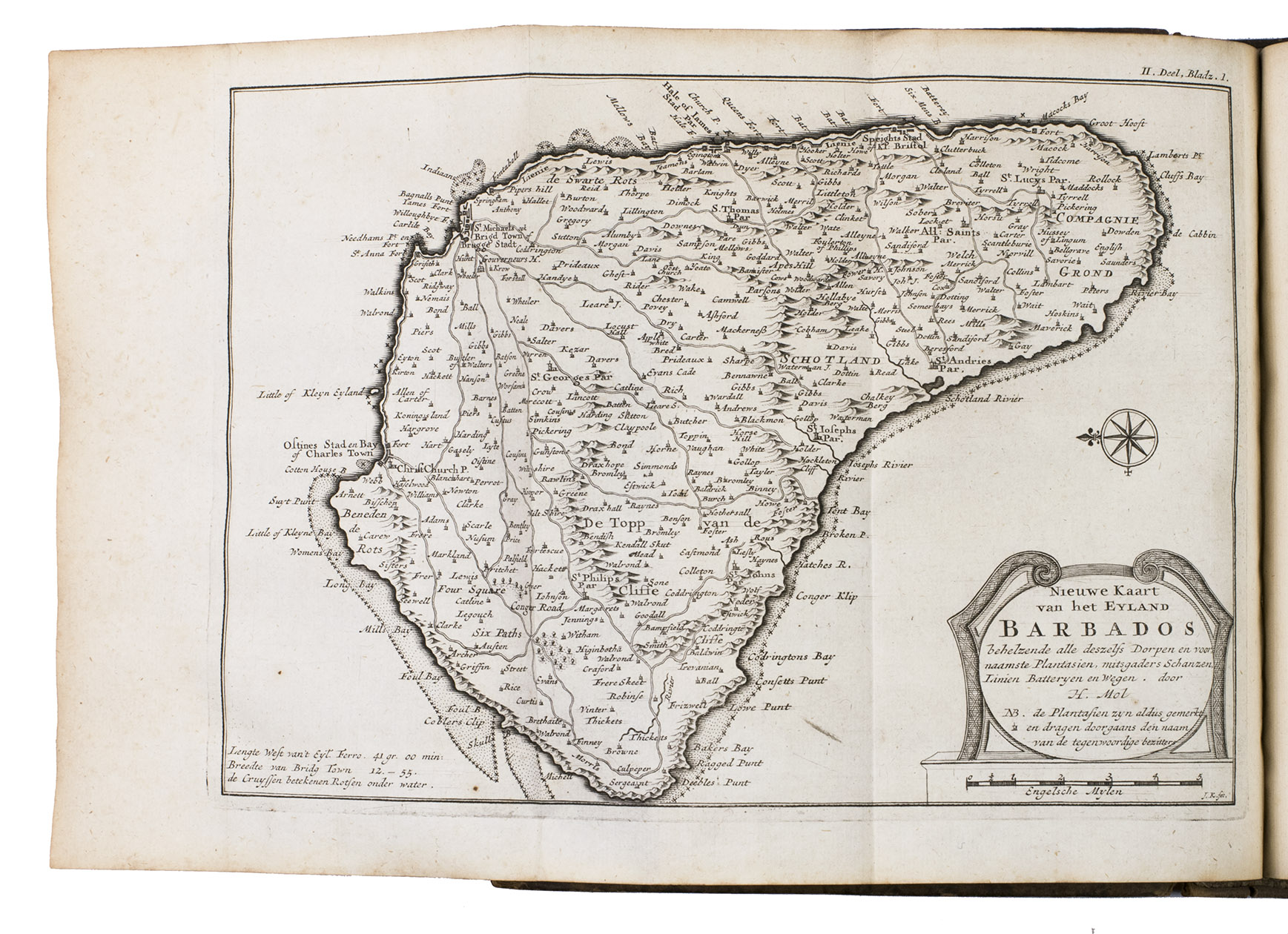
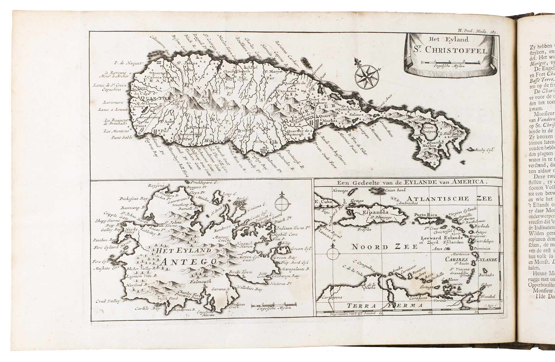
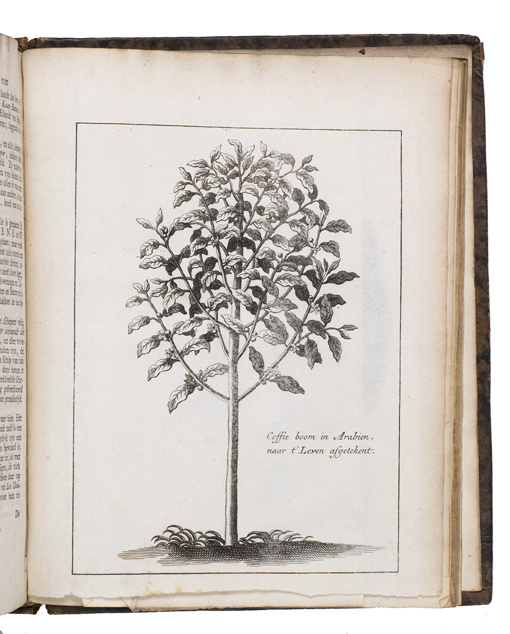
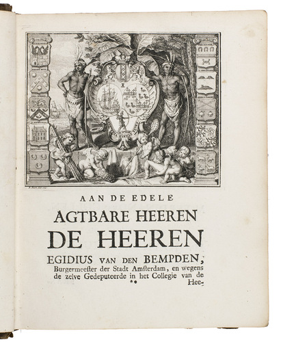
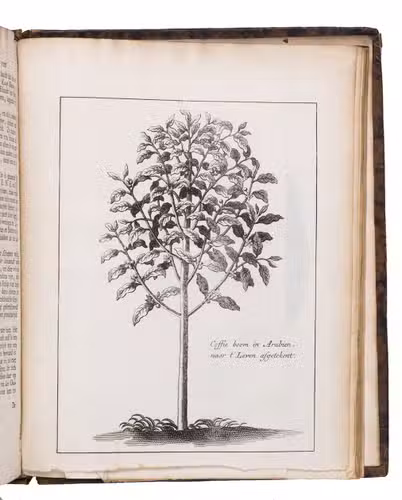
Amsterdam, Rudolf & Gerard Wetstein, 1721. 2 parts in 1 volume. 4to. Part I: Engraved frontispiece by J. Goeree dated 1720, title in red and black, 5 folding engraved maps, engraving in text, woodcut headpieces and initials. Part II: Engraved frontispiece by J. Goeree dated 1720 (same as in part I), title in red and black, 3 folding engraved maps, folding engraved plate, 2 full-page engraved plates, woodcut head- and endpieces and initials. The maps are by J. Keyser after H(erman) Moll. Contemporary full calf. (26), 300 (i.e. 296); (2), 327 (14, 1 blank) pp.
€ 6,500
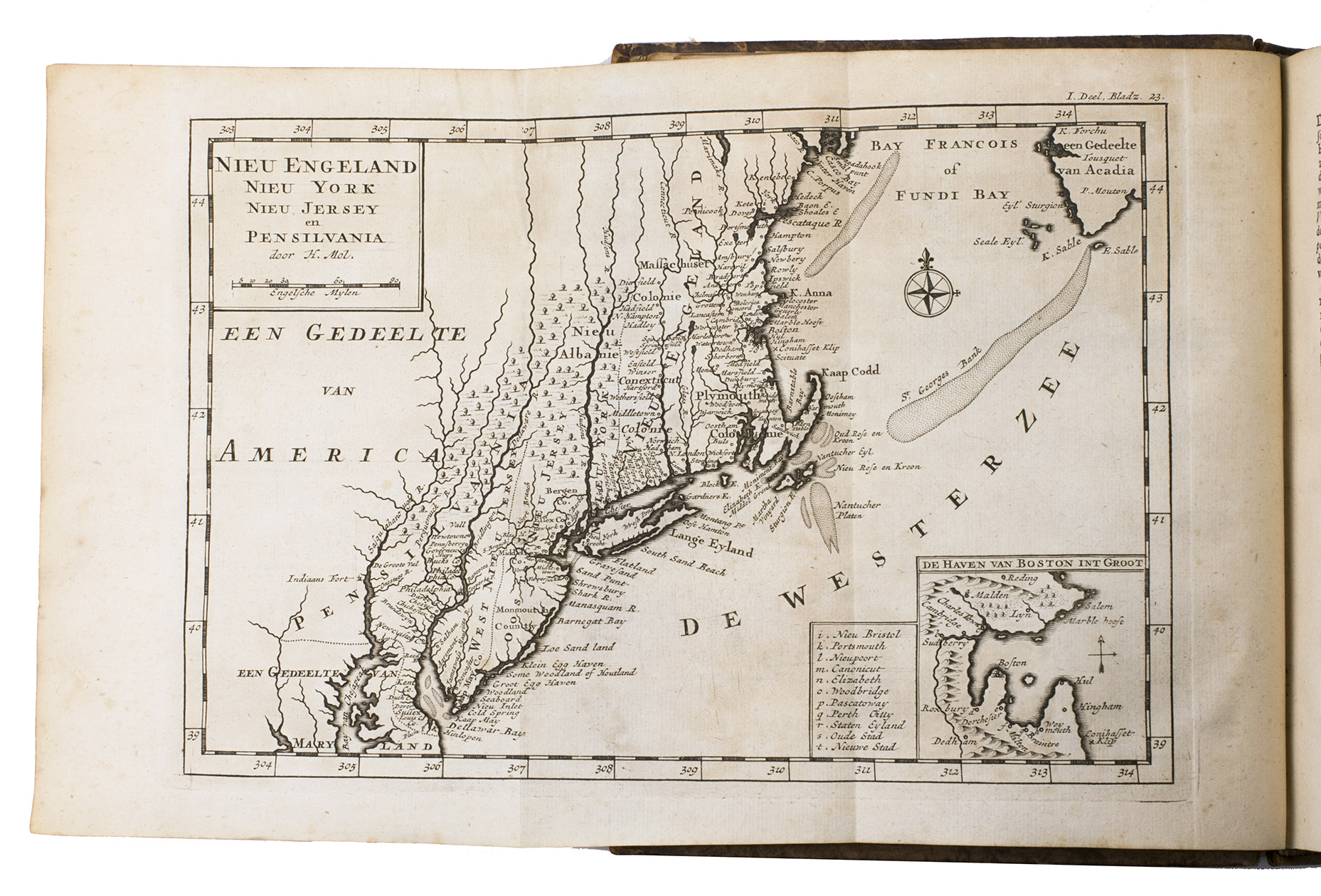
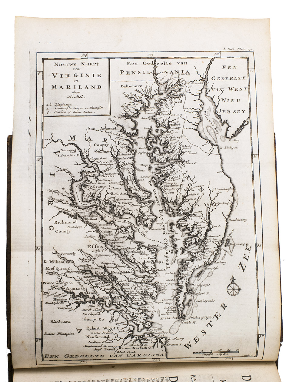
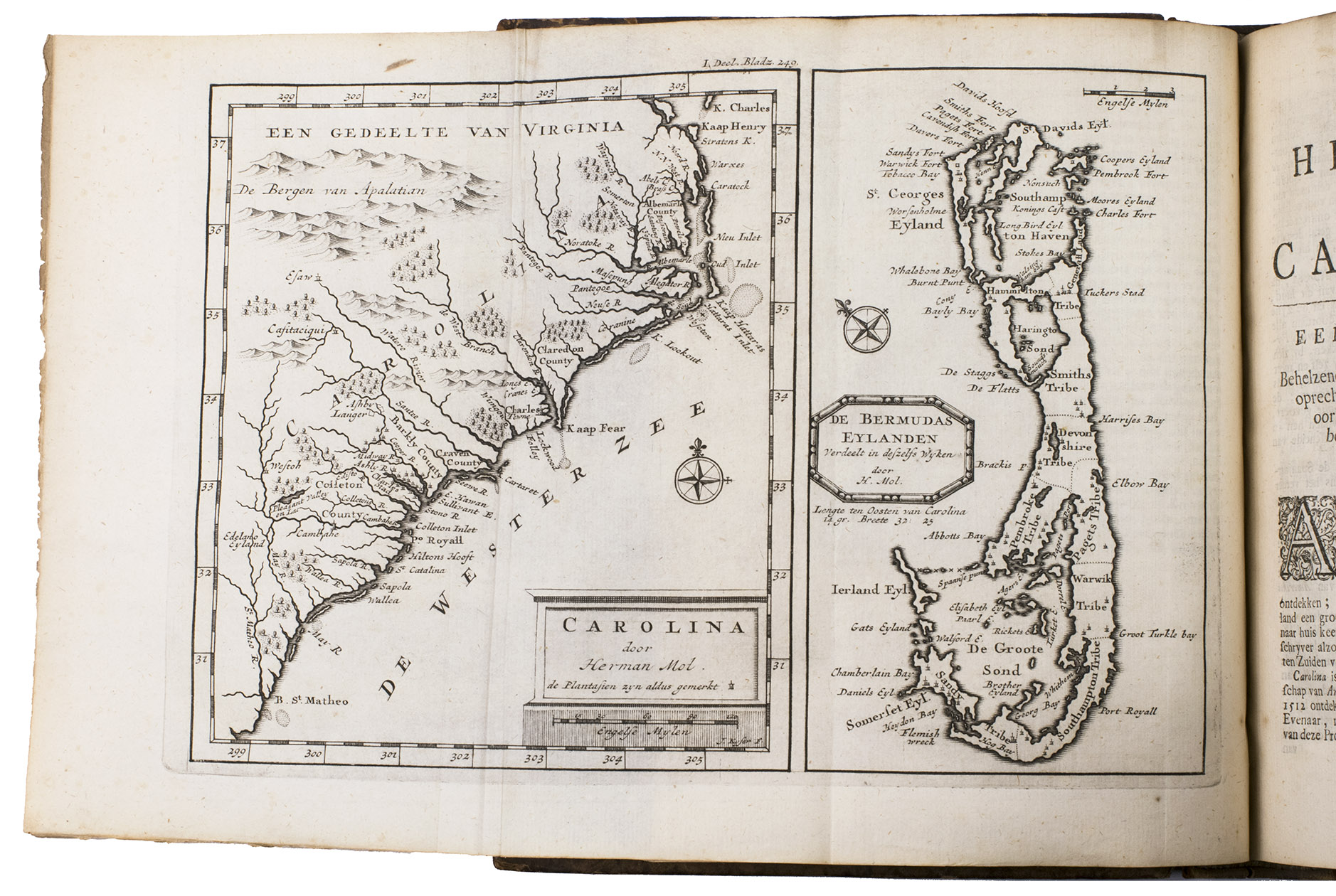
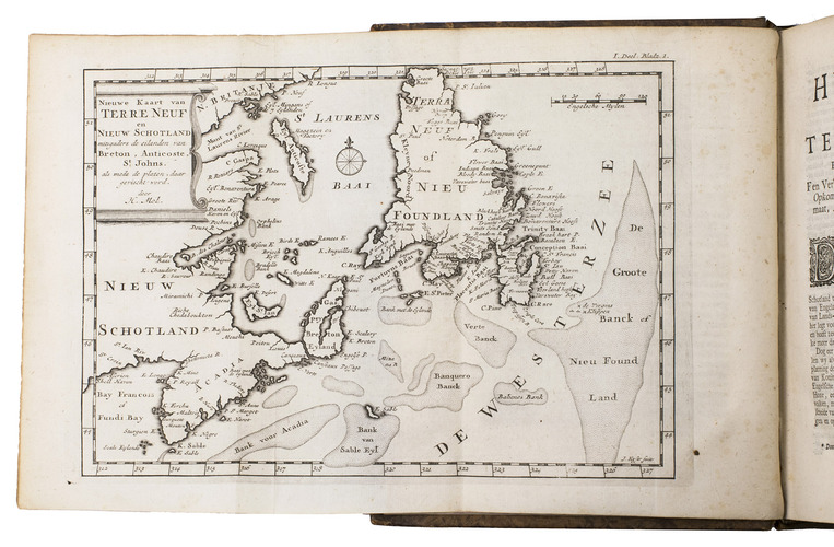
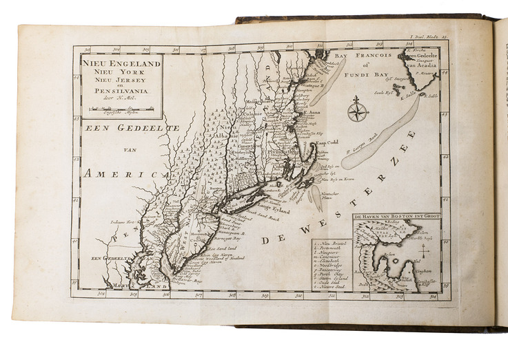
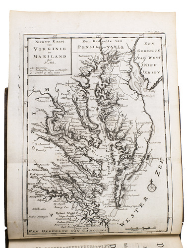
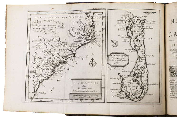
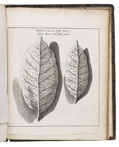
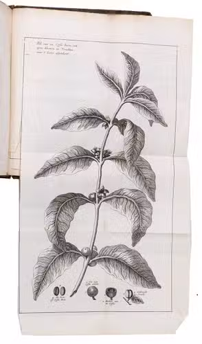
Dutch translation of The British Empire in America (London 1708) by John Oldmixon, containing an account on coffee and coffee plantations that is not present in the English edition. In the first part, the author describes North America (New Foundland, Nova Scotia, New England, New York, New Jersey, Pennsylvania, Maryland, Virginia, Carolina, Hudson Bay) and part two deals with the British colonies in Central America (Barbados, St Lucia, St Vincent, Dominica, Antigua, Montserrat, Nevis, St Christopher, Barbuda, Anguilla, Jamaica and Bermuda). The author discusses the discovery, history, geography, population and economy of each of these regions. He is very well informed, providing many interesting details.
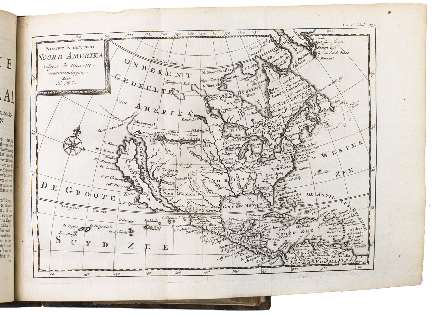
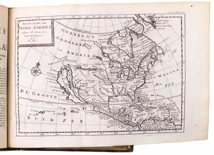
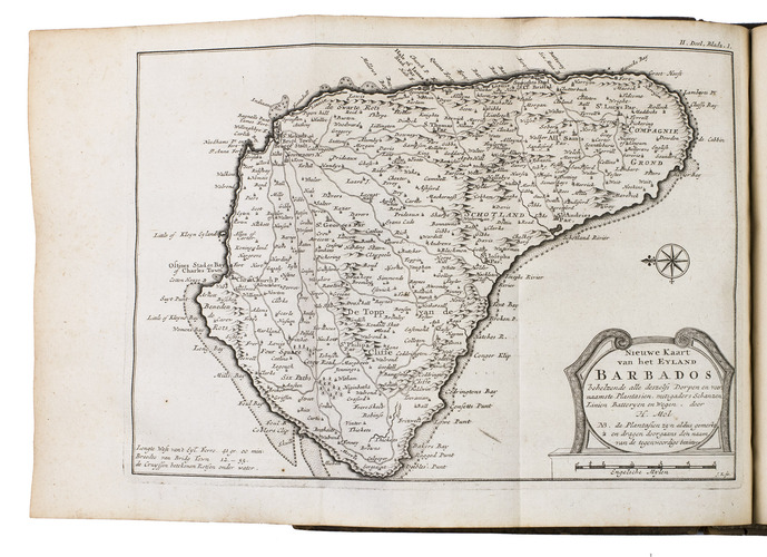
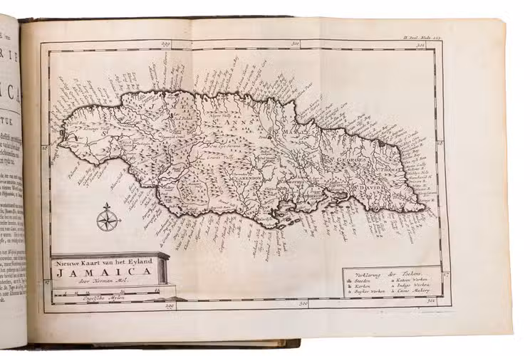
The maps show New Foundland (17.5 x 25 cm), New England, New York, New Jersey and Pennsylvania (17.5 x 25.5 cm), Virginia and Maryland (25.5 x 17 cm), Carolina and Bermuda (two maps on one plate), North America (depicting California as an island!), Barbados (showing the names of the plantation owners ), Antigua, St Christopher and an overview of the Caribbean (three small maps on one plate) and Jamaica. The maps measure about 17.5 x 25.5 cm except the map of Virginia and Maryland (25.5 x 17.5 cm). According to the text on the maps, they have been made by Herman Moll and engraved by J. Kyser (Tooley, Dict. of Mapmakers, p. 366; not in V.d. Krogt, Bibliografie ). Tooley merely lists Kyser in connection to Moll's map of Carolina. We were unable to find information on the production of these particular maps, with exception of the map of North America, depicting California as an island which is recorded by McLaughlin (200). We presume that Kyser engraved the maps on a smaller scale and changed some of the geographical names into Dutch after existing maps by Moll.
A fine copy of this informative work on America. Alden & Landis 721/139; Sabin 57160; Tiele, Land- en Volkenkunde 192; ad map: McLaughlin, Mapping of California as an Island (1995) 200.
Related Subjects: