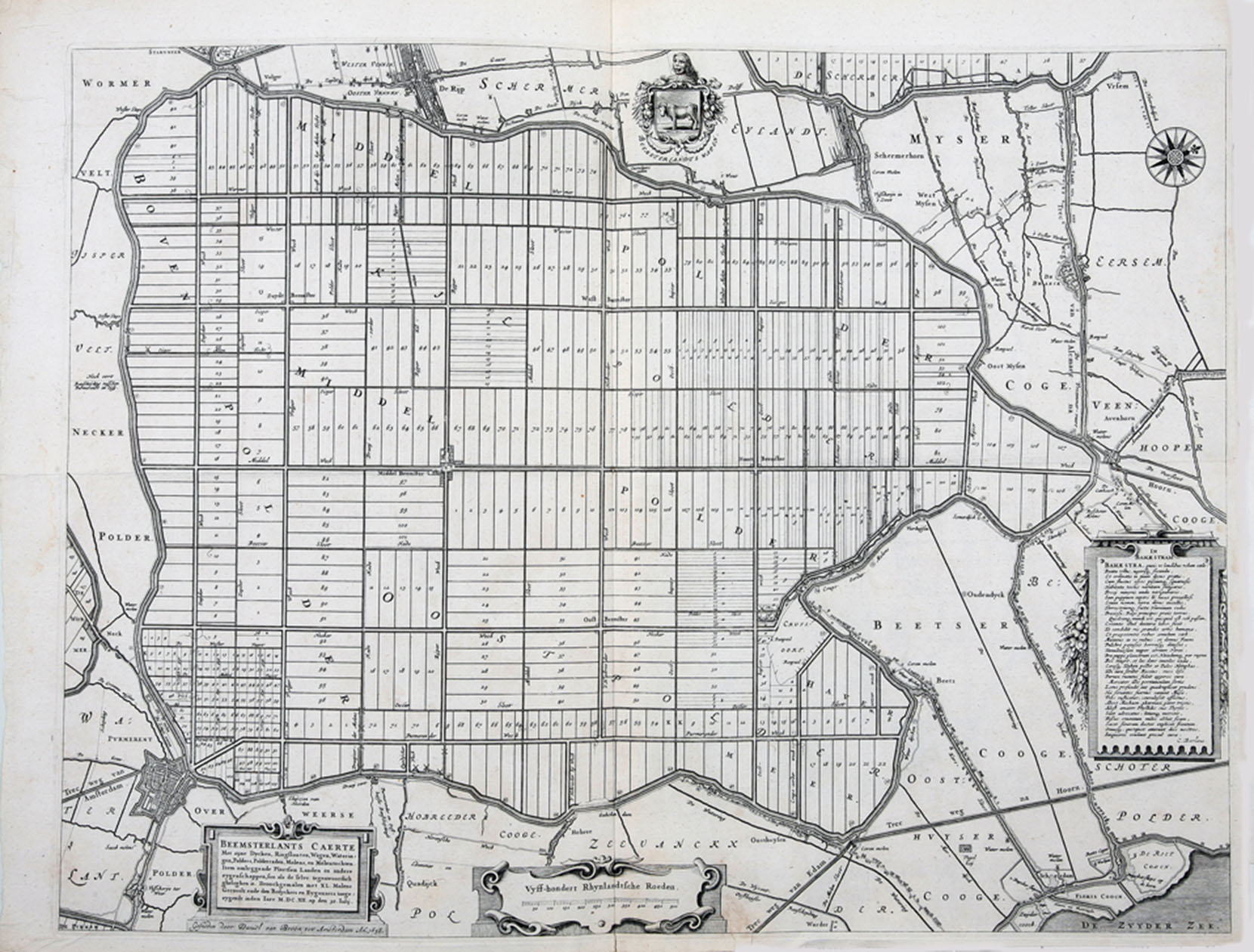
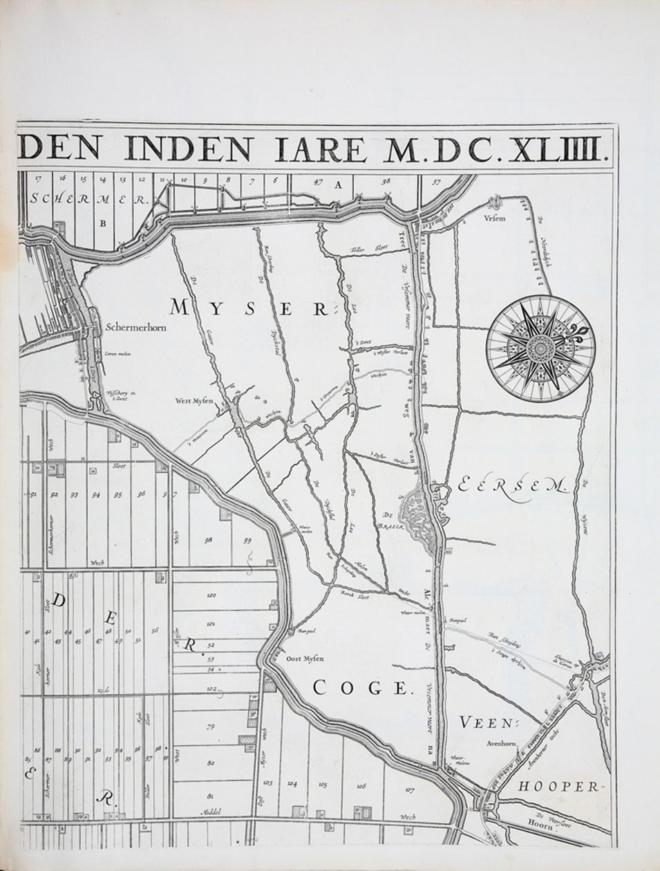
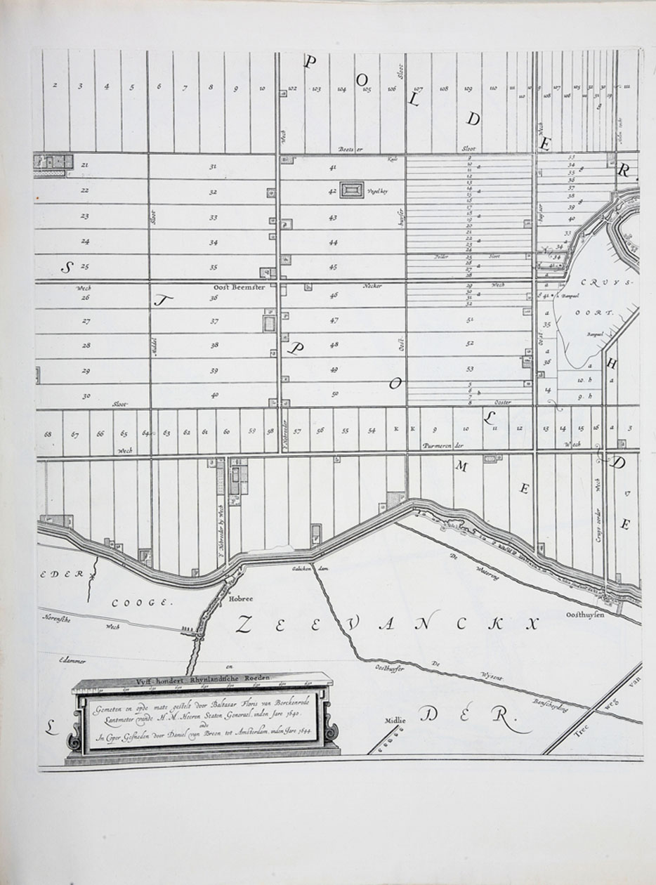
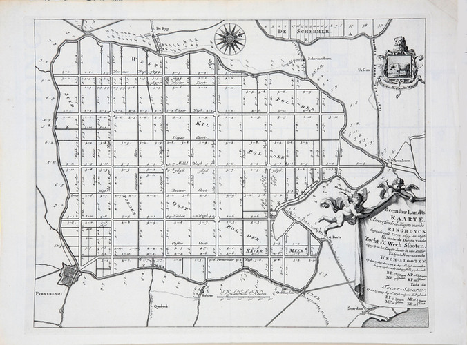
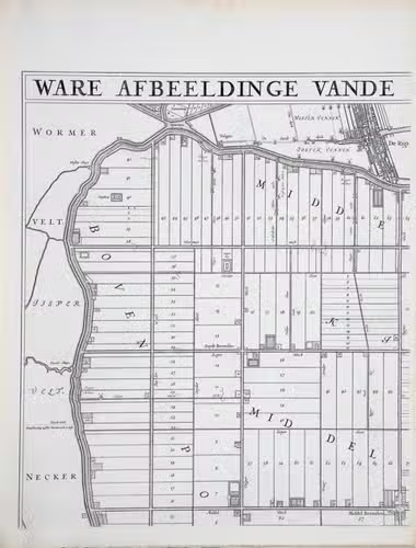
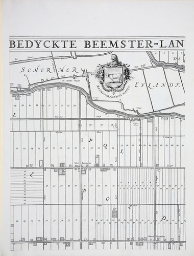
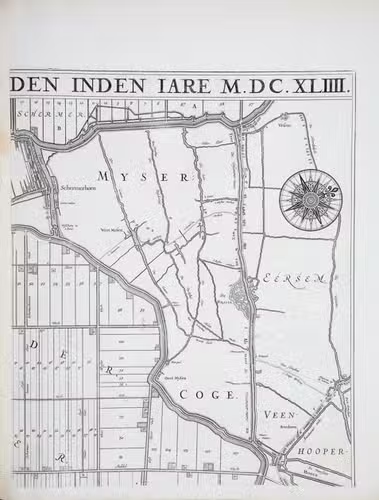
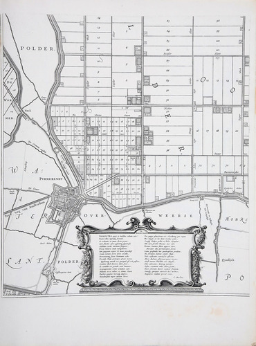
[MAP - NETHERLANDS - BEEMSTER]. FLORISZ. VAN BERCKENRODE, Balthasar and Daniel van BREEN.
Beemsterlants caerte... [with a second title at the head:] Ware afbeeldinge vande bedyckte Beemster-landen... M.DC.XLIIII.
Amsterdam, 1644 [reprinted ca. 1769?]. Engraved map in 6 sheets (each 56 x 44 cm).
With:
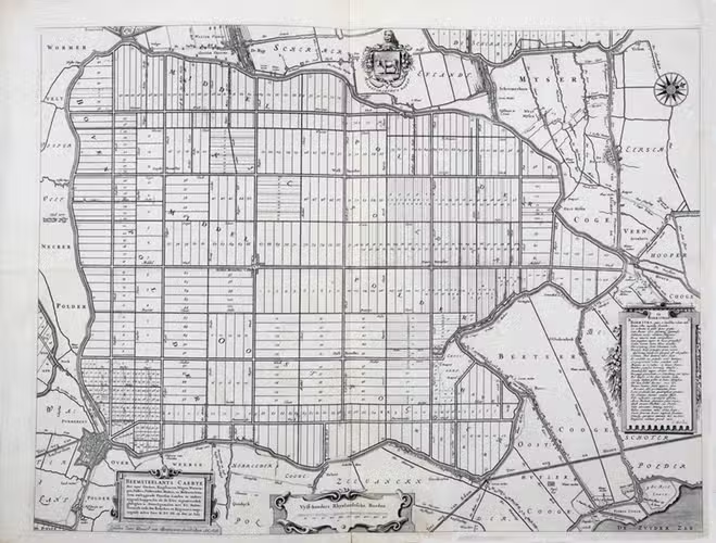
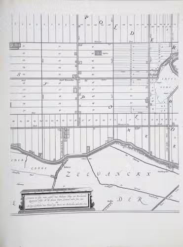
(2) [FLORISZ. VAN BERCKENRODE, Balthasar] and Daniel van BREEN. Beemsterlants caerte...
Amsterdam, 1658. Engraved map (43.5 x 58 cm).
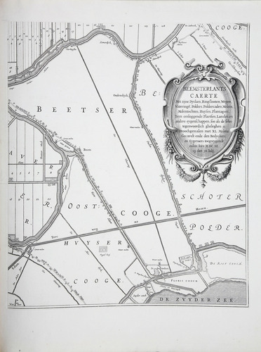
(3) Beemster landts kaarte, aenwijsende de hoogte vande ringhdyck.
[Amsterdam(?), ca. 1696]. Engraved map (28 x 35.5 cm).
(4) DORLAND, C. [2 maps of the Beemster].
Amsterdam, Tresling & Co., March 1908. 2 nearly identical chromolithographed maps (ca. 28 x 36 cm), the first partly and the second wholly coloured.
(5) Waterschap de Beemster.
February 1970, updated to 1979. Large map (64 x 50 cm).
Collection of 6 maps (the first in 6 sheets). Bound in modern cloth (57.5 x 47 cm).
€ 3,750
Interesting collection of maps of the Beemster polder, which in the 16th century was an eight by nine kilometre inland sea north of Amsterdam. Its reclamation in the years 1607 to 1612, financed largely by the Dutch East India Company, was one of the most ambitious of the early 17th-century drainage projects. Dykes were built and the water was pumped out by 41 windmills, creating a large polder with sorely needed residential and above all farming land near the rapidly expanding city of Amsterdam.
Including: (Ad 1:) Apparently the last reprint, not reported in the literature, of a magnificent map of the Beemster Polder, on a scale of about 1:11,500, which "may be called the finest water-authority map of this era" (Fockema Andreae, Gesch. Kartografie Nederland, p. 36). The land was surveyed and the map drawn in 1640 by Balthasar Florisz. van Berckenrode and engraved in 1644 by Daniel van Breen. (Ad 2:) Rare reduced version, in its first state, of the map of the Beemster by Balthasar Florisz. van Berckenrode and Daniel van Breen. It was issued in a second state in 1769, revised by Jan Switsers. (Ad 3:) Rare surveyor's map clarifying the state of the dyke of the Beemster polder. (Ad 4-5:) Three modern maps of the Beemster. A few small tears along the edges (ad 3) and a minor dampstain in two leaves (ad 1). Collection of maps of the Beemster in very good condition. Ad 1: cf. Donkersloot-De Vrij 130; Hameleers (1984) 13; De Vries, Beemsterlants Caerten 10 (none mentioning this printing); ad 2: Donkersloot-De Vrij 130 note; De Vries, Beemsterlants Caerten 12A (5 copies); ad 3: De Vries, Beemsterlants Caerten 13 (5 copies).
Related Subjects: